
kanjis of the day
guyuan - zhangleanqi
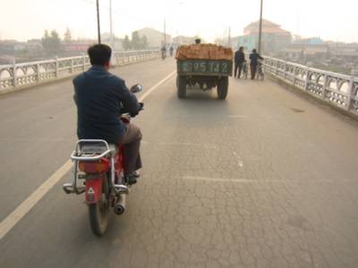
a buddy guiding me out of guyuan
behind a coffee in beijing I had already figured out my maps wouldn’t help me that much. thought I was well prepared though – from a specialized bookstore in tokyo I had bought a northern china road map and a slightly more detailed aviation map, supposedly the best one availabe. but comparing both maps to set out a tentative itinerary turned out to be a worrying affair: roads and even place names didn’t coincide. find the seven similarities…
outside of the coffee bar, different worries. apart from being inaccurate and too small for a bike trekking (my daily 100km corresponding with a pathetic 5cm), both maps depict place names in latin characters only, making them completely cryptical for the average chinese along the road. very few locals read latin characters, even less seem to have an idea what their region looks like from above. while I had no tools to decode the average road sign…
speech didn’t help me a lot further either. mandarin is an intonational language, with four tones, (unlike japanese) very hard to transcribe, and impossible to pronounce… being misunderstood is annoying, but being mute while speaking is hopelessly frustrating. even when I tried twenty different pronounciations of the next town’s name, still not a single face out of the full screen collection gathered around me would show a sign of remote recognition. a recurrent nightmare… [jesus, what the hell could I possibly be trying to say, with a map in my hands and a bike under my ass?]
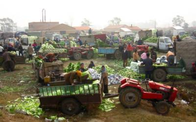
faces turn around, hands keep trading cabbage - a common sight at guyuan's saturday market

but in the end all works out fine, even for a mute traveler with blind maps. pretty quickly I learned to depend on the position of the sun and the shape of the land (the aviation map having topography lines), to change my definition of ‘working out fine’. and to find the kanjis of the day, the chinese characters corresponding with the town I wanted to reach.
one day one of the faces brought me to the local ‘middle school’, interrupted a class without apologizing and had the geography teacher study my map. I walked out of the school with kanjis for a couple of days…
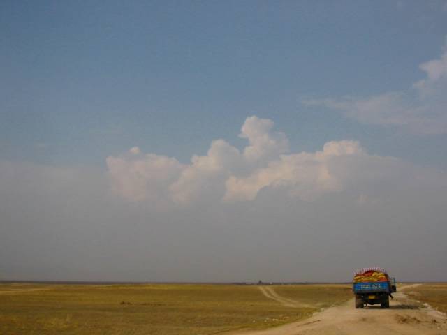
lack of maps turns every day into a little pilgrimage. this one, the first day on the grasslands, in particular, since the town to reach goes under a couple of names, ranging from zhangleanqi (on the map) to something that sounds like ‘lanxie’…
I try “zhangleanqi?” while pointing in a certain direction / question mark faces / get off my bike, show them the kanjis / “aaaah, lanxie!” nodding heavily and showing me the way //// next fork, same story, zhangleanqi and lanxie interchanged /// etc

next fork

lunch in a hui village
with other muslim minorities, the hui make up almost 10% of the chinese population. still I was surprised to find them so far east on the silk road... opposite to the cats, there's a poster of mekkah with a quote from the quran.
here, as in most 'restaurants' during the first week, I had a plate of jaouza, dumplings stuffed with mutton and scallions. a classic, safe, and easy to order. only later I found the kanjis for "house specialty" - a secret code to a way more exotic universe, dished up by proud chefs...
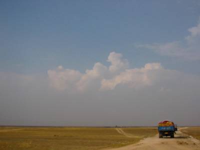
picture the disappointment when at the end of the day, zhangleanqi slash lanxie is just another unhospitable concrete settler’s camp. dust blasting through the town’s two oversized cartboard boulevards. brand new factories on the outskirts. feels like zhangleanqi has been dropped off by a couple of trucks just last week. at night, no one outside, loud laughter from behind dirty windows. the wild west.
this is inner mongolia, just like other ‘autonomous regions’ in china the forefront of state organized han chinese colonisation. until a couple of decades ago these grasslands – roughly beyond the great wall – were used as pastures by semi-nomadic mongolian shepherds, while intensive agriculture stopped at the end of hebei’s fertile valleys. today, the mongolians, of which the majority has been forced to settle down, are outnumbered by han chinese by nine to one. this might explain the disappointing geographical knowledge of the 'locals'. it definitely explains the sand storms in beijing…
towns like zhanleanqi will only get more depressing as I move on north, higher on the mongolian plateau, to colder, more fragile ecosystems.

notice the mongolian style dome on the new building... duck or decorated shed?

a buddy guiding me out of guyuan
behind a coffee in beijing I had already figured out my maps wouldn’t help me that much. thought I was well prepared though – from a specialized bookstore in tokyo I had bought a northern china road map and a slightly more detailed aviation map, supposedly the best one availabe. but comparing both maps to set out a tentative itinerary turned out to be a worrying affair: roads and even place names didn’t coincide. find the seven similarities…
outside of the coffee bar, different worries. apart from being inaccurate and too small for a bike trekking (my daily 100km corresponding with a pathetic 5cm), both maps depict place names in latin characters only, making them completely cryptical for the average chinese along the road. very few locals read latin characters, even less seem to have an idea what their region looks like from above. while I had no tools to decode the average road sign…
speech didn’t help me a lot further either. mandarin is an intonational language, with four tones, (unlike japanese) very hard to transcribe, and impossible to pronounce… being misunderstood is annoying, but being mute while speaking is hopelessly frustrating. even when I tried twenty different pronounciations of the next town’s name, still not a single face out of the full screen collection gathered around me would show a sign of remote recognition. a recurrent nightmare… [jesus, what the hell could I possibly be trying to say, with a map in my hands and a bike under my ass?]

faces turn around, hands keep trading cabbage - a common sight at guyuan's saturday market

but in the end all works out fine, even for a mute traveler with blind maps. pretty quickly I learned to depend on the position of the sun and the shape of the land (the aviation map having topography lines), to change my definition of ‘working out fine’. and to find the kanjis of the day, the chinese characters corresponding with the town I wanted to reach.
one day one of the faces brought me to the local ‘middle school’, interrupted a class without apologizing and had the geography teacher study my map. I walked out of the school with kanjis for a couple of days…
lack of maps turns every day into a little pilgrimage. this one, the first day on the grasslands, in particular, since the town to reach goes under a couple of names, ranging from zhangleanqi (on the map) to something that sounds like ‘lanxie’…
I try “zhangleanqi?” while pointing in a certain direction / question mark faces / get off my bike, show them the kanjis / “aaaah, lanxie!” nodding heavily and showing me the way //// next fork, same story, zhangleanqi and lanxie interchanged /// etc

next fork

lunch in a hui village
with other muslim minorities, the hui make up almost 10% of the chinese population. still I was surprised to find them so far east on the silk road... opposite to the cats, there's a poster of mekkah with a quote from the quran.
here, as in most 'restaurants' during the first week, I had a plate of jaouza, dumplings stuffed with mutton and scallions. a classic, safe, and easy to order. only later I found the kanjis for "house specialty" - a secret code to a way more exotic universe, dished up by proud chefs...
picture the disappointment when at the end of the day, zhangleanqi slash lanxie is just another unhospitable concrete settler’s camp. dust blasting through the town’s two oversized cartboard boulevards. brand new factories on the outskirts. feels like zhangleanqi has been dropped off by a couple of trucks just last week. at night, no one outside, loud laughter from behind dirty windows. the wild west.
this is inner mongolia, just like other ‘autonomous regions’ in china the forefront of state organized han chinese colonisation. until a couple of decades ago these grasslands – roughly beyond the great wall – were used as pastures by semi-nomadic mongolian shepherds, while intensive agriculture stopped at the end of hebei’s fertile valleys. today, the mongolians, of which the majority has been forced to settle down, are outnumbered by han chinese by nine to one. this might explain the disappointing geographical knowledge of the 'locals'. it definitely explains the sand storms in beijing…
towns like zhanleanqi will only get more depressing as I move on north, higher on the mongolian plateau, to colder, more fragile ecosystems.

notice the mongolian style dome on the new building... duck or decorated shed?
posted by Jan at 14:42
![]()
<< Home